Day46-49 Grand Teton National Park – Jun 25 – 28

Day46 Indian Creek CG to Gros Ventre CG – Jun 25
Today we make the long run back to our original base camp at Gros Ventre campground in the Grand Teton NP.  It will take the better part of the day, as we have about 150 miles to run, the speed limit is 45 mph or less and I can seldom go that fast with the trailer, we have to account for traffic and we also have to accommodate impromptu nature events.  We also want to stop off at Old Faithful Village on the way back for some souvenir shopping.

We make good time getting back, despite a small delay in the south end of Yellowstone for some road maintenance.  Once we clear the south gate, it is pretty much smooth sailing as we are completely out of the traffic all the way to Gros Ventre.

We make camp, have lunch and clean up a bit, then head into Jackson for a little more souvenir shopping.  We close up most of the shops and help them roll up the sidewalks for the night.

This is the view out the front window of the camper at our last campsite at Gros Ventre in the Grand Teton NP.

Day47 Dubois, WY – Jun 26
Today we head into Dubois for a little shopping and a bit of nostalgia from earlier in the trip.  If you have not already read Day33, go back and do so.  I had a grand time there, and Tracey wanted to see the town and I wanted to take her to a couple of the galleries there.  We take up the better part of the day wandering about town, having lunch and doing just a smidge more souvenir shopping.  I take her to the local bead store, and this turns out to be a gold mine for entertainment, local lore and souvenir shopping.

We head back late afternoon so Tracey can get a head start on packing for her trip home tomorrow.

Day48 Jackson, WY – Jun 27
Tracey finishes up her packing and we load up and head into Jackson one last time for one or two last minute souvenir acquisitions, a nice lunch and to take her to the airport for a late afternoon departure.

After leaving the airport, I head back to camp to grab my grocery list and the LP tank that went dry the night before.  One more trip into Jackson for provisions and it’s back to camp to put away groceries and begin stowing my gear for moving day on Sunday.

Just a quick comment about Tracey.  I can honestly say that I had a grand time when she was here.  Yellowstone and the Tetons are an unbelievable experience, but she made them all the more memorable.  By having along a hiking partner with similar interests, I was able to experience these two national treasures all the more and will always remember this part of the trip fondly.  She was very outgoing and personable with those we met along the way and was always curious about their hometowns, experience in the parks and their plans for the future.  And if anyone ever needed a group photo, she was always right there to squeeze the shutter for them.

I will miss you a ton Miss Tracey.  You definitely brought some sorely needed sunshine to my trip.

Day49 Gros Ventre Slide; Mormon Row – Jun 28
Today I head out early to hike the Gros Ventre Slide in a neighboring national forest.  This slide is one of the largest natural occurring movements of earth ever recorded.  On June 23, 1925 the entire side of one mountain came crashing down into the Gros Ventre River and up the mountain on the other side.  Eyewitnesses say that it looked like water rushing down the mountain the splashing about the face of the neighboring hillside.  The slide formed a natural dam across the Gros Ventre River and a new lake was born.

Two years later, this dam broke loose and the waters rushed downriver, killing 6 in the nearby village of Kelly.

There is a short interpretative hike on the remains of the slide in which you can see the carnage of rock and lumber scattered about like so many pixie sticks.  It is interesting to see boulders of this size, just thrown into a pile like some giant earth mover just left it there.

I had intended to go further up the road for more hiking, however, a much more recent rockslide had the road blocked off, so I headed back towards the Tetons and camp.  Stopping along the way for numerous photo opportunities, a couple of short hikes and some socializing with other tourists (Tracey would be so proud!).

Note on the following photos:  For whatever reason, this was one of my most prolific days behind the camera.  Only 125 photos, but each one as good or better than the last.  I really had a hard time selecting the best, and finally just figured it didn’t matter if they were both good.  Please enjoy.
 
The Gros Ventre Slide.  Tracey – What made these marks on this Aspen Tree?!?
 
 
The Tetons from the slide area and a cabin in the hills
 
Room with a view and an old Wyoming Cowboy (proof that I used the tools Tracey left me)
 
Two shots of the Mormon Barn

Posted in USAmble | Comments Off on Day46-49 Grand Teton National Park – Jun 25 – 28

Day42-45 Yellowstone National Park (North) – Jun 21 – 24

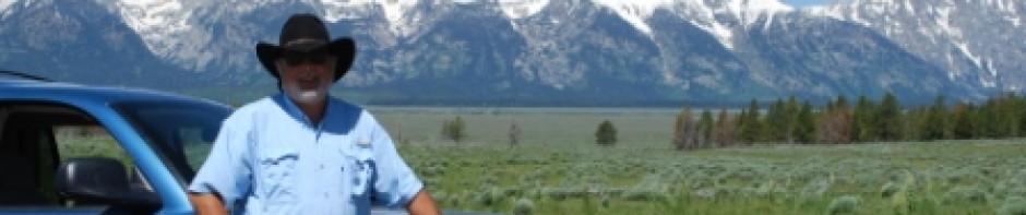
Day42 Indian Creek Campground – Jun 21
Moving day!  We are out the door early headed to the North end of the park.  All of the Yellowstone campgrounds have been filling by mid-afternoon for the past week, so we are making a bee-line for our first choice.  The ranger at Fishing Bridge recommended Indian Creek and in fact stated it was her absolute favorite, so we go straight there.

An interesting phenomenon that occurs at Yellowstone and the Tetons is ‘Bison Jams’ or ‘Elk Tie-ups’ or as I like to call them, ‘impromptu nature events’.  Despite all the information that the park service provides instructing people about the courtesies and safety measures to take when experiencing wildlife in the park, there seems to be no shortage of people who fail to grasp that it is not safe to get out of the car and walk up to a bison, nor is it okay to stop the car dead center in the road and take pictures out the window while pointing out the animals to the kiddies like it’s some kind of zoo!

On our trip north we get stuck in one of these INE’s and literally have to sit and wait for folks to watch and photograph a bear.  One fella even parks his car dead center in the road and leaves his vehicle to go take pictures.  So, the traffic behind him tries to use the oncoming lane to get around him, and of course traffic coming the other direction has to yield to prevent a head on collision.  But there are other vehicles blocking the road ahead, so they really have no place to go and so we are all in total grid lock.  It would be quite comical if it were not so frustrating.

For the record, we got several shots out of the car window, however we were either already stopped dead waiting for traffic, or were out late on a desolate stretch of road with no traffic around us.  Lots of our shots were while away from the vehicle, either during a hike or after we pulled off of the road.  Tracey has some great shots from our day hikes and backpacking trip.

You also learn quickly to set yourself up for a quick exit when using the road pull-offs.  If you don’t plan accordingly, someone will inevitably pull in behind you and block you in so you can’t leave.

Okay, so I am off of the soap box now . . .

No, I’m not.  As a postscript there was an article in the local paper on Saturday that a 10-year old boy had gotten thrown by a bull bison while posing for photos with his family just a few feet from the animal.  He was transported to a hospital in Idaho Falls but no report on his condition.  Park rules dictate that you stay 25 yards from bison, and obviously his parents are illiterate.

After making camp at Indian Creek, we head up into Mammoth Springs, the northern most village at Yellowstone.  We head straight to the visitor’s center, look around a bit, then walk into the Backcountry office for our backpacking permit.  Tracey talks over a couple of potential hiking itineraries with the Ranger and we settle on a site just 3 miles in from the trailhead at Hellroaring Creek.  I really think she picks her hikes and campsites based on the name alone.  Note to the Park Service marketing team . . . .

After we get our permits, sit through the training video, and admire some of our fellow hikers and their hiking choices (hoo boy!), we take in some of the local sites.  Tracey walks through the museum, but I decide to take the walking tour about town.

Mammoth Springs happens to be the Headquarters for Yellowstone National Park.  It was also the site of Fort Yellowstone, back when the park was in its infancy.  The park service did not exist at the time, so the US Army was charged with security at the park, and so stationed two cavalry units here to control access and flush out poachers.  Therefore, many of the structures within Mammoth Springs are from that era and have a storied history.  Eventually, the Park Service was established, and the Calvary Companies were discharged and hired into the Park Service and became the very first Park Rangers.

After our respective tours we stopped into the local store for some refreshments, and then head to the edge of the village to visit the hot springs.  This was a very interesting landscape and included a 250+ stairway climb to some viewing platforms.  Many of these provided scenic views of the springs themselves as well as the village.

We make a quick run north into Gardiner, Montana and see the Roosevelt Arch which was once the ‘main’ entrance into Yellowstone.  We stop in a local coffee house for coffee, ice cream and some internet time with our computers, then head back to camp for the night.

Fort Yellowstone, USGS Monument (calibrate your GPS folks, 6259.216 feet elevation), Corp of Engineers Building (Reece, you need to look this one up.  Hint:  Engineer’s office, designed in 1903 by Hiram Chittenden of the U.S. Army Corps of Engineers) and the Roosevelt Arch

Trees in the Hot Springs, View of Mammoth Hot Springs (Fort Yellowstone is to the right behind the trees) and a Coyote (I think Tracey shot this with my Camera)

Day43 Canyon Village – Jun 22
The Grand Canyon of Yellowstone.  We head out early and stop in the village for a little shopping before heading to the canyons for some hiking.  Tracey and I both pick up some souvenirs, grab a cup of coffee and head to the hiking area.  The first pull off is an easy walk and very popular.  We walk down the trail all the way to the bridge and take in several different vistas of the river and waterfalls.

We hike back to the car and drive around to the south rim.  This area gets even more traffic as there are a number of short easy walks to some spectacular views.  We eat lunch in the car, then gear up for a 6-mile loop hike.  We start by taking photos at the overlook that a thousand people a minute visit, then walk up the canyon stopping to take in the views and shoot lots of photos.  We opt out of the 250 stairs walk down to the base of the falls and continue up to trail.  We then cross over the main road and follow the trail through meadows and some hot springs until we once again intersect the river canyon and hike back up to the trail head.

What amazes me about this trip thus far, is that every time I come around a corner and see a spectacular view, I think it just can’t get any better.  Then, I turn another corner and I am proven wrong again.

Yellow Yellowstone Bus, and two views of the Falls in the Grand Canyon of Yellowstone.  Simply breathtaking!!!

Osprey in Flight, another view of the falls and a Black Bear cowering from all of the tourists attention

Day44 Hellroaring Creek – Jun 23
Today we step out onto another overnight hike.  This hike heads downhill almost immediately, and continues all the way to our designated campsite, 2H2 about 3 miles in.  The campsite is located at the confluence of Hellroaring Creek and the Yellowstone River.  The good news is that the hump in is all downhill, the bad news.  It’s a substantial pull out the next morning.

We get out the door early enough and hit the trailhead well prepared.  There is just one little glitch.  As I head up the road near the parking area, I begin to feel ill as we get closer and closer.  I park the Durango and tell Tracey that I am not feeling well.  I move over into the passenger seat and she suggests I test my blood sugar.  Good idea!  76!!  Way too low to start hiking let alone carrying a backpack.  We start feeding the monster and recovery takes well into the afternoon, so we wisely cancel our plan.

I take a little nap, and Tracey goes down the trail about a mile or so and returns.  While we wait a bit for me to feel better, we observe the usual trailhead activity of coming and going of hikers.  One group in particular is three men and a young teen from Louisiana who are setting out on a four-day hike.  This is this young lad’s first experience.  Watching the packing process is a hoot.  They have sleeves of Ritz crackers and baggies of fried fish.  Not your usually backpacking fare.  We also meet a lovely couple from Holland, and I give the gentleman a ride back to their starting point to retrieve their (Mr Alamo’s) vehicle.

After my return, we head down the road a bit for a bathroom break at the Roosevelt lodge.  This particular facility has been host to Teddy (thus the name) and his friend John Burroughs in its day.  This is a very historic and very rustic site, but really crowded from so much tourist traffic.  This would be a very cool place to hang in the off season.

We head back to camp for me to finish recovery and we both get some well needed rest.  We use Tracey’s camp stove to make our backpack dinner and also have a campfire for the first time this trip.  All in all, a very relaxing afternoon.

Day45 Mammoth Springs – Jun 24
Day hikes galore!!!  To make up for the missed backpacking trip, and to make things a bit easier on ourselves, we decide on a series of short hikes that are relatively close to our base camp at Indian Creek, yet will give us both a bit of a workout, and opportunities for more photos.

We start at Wraith Falls which we find closed upon our arrival for trail maintenance.  We move back up the road a bit to Lava Creek for a few pictures of the waterfront and ourselves as we both play around with the auto functions on our cameras.  We then move further back to Undine Falls and hike down to the top of the falls for more photo opportunities.  Unfortunately, there is no real good way to get down into the gorge, so we make do with top end shots.

We head back to camp for lunch and a quick nap, then go to Sheepeater Cliff just a couple of hundred yards away from the campground entrance.  We pick our way down the trail to the top of this gorge and find what I believe to be one of the best views of the trip so far as the falls break out into a sheltered field.  Almost looks like an auditorium or stadium when the lighting is just right.

For dinner we make the short run up to Gardiner, Montana again.  We take advantage of the time in town to check e-mails and banking then head home to pack up for another moving day tomorrow as we have to head back towards Jackson to prepare for Tracey’s scheduled departure on Friday.

Lava Creek, then two shots of the river above Undine Falls

Above Undine Falls, Undine Falls (tough to get a clear shot of this one due to the canyon and wildflowers

These last five shots are from the hike in Sheepeater Canyon

p.s. A note about Sheepeater Canyon.  I had a conversation with a local and it seems that the Sheepeaters where a band of the Shoshone’s.  There are apparently 37 different bands and they are each named for their primary food source, thus the Sheepeater’s.  Just a bit of local lore for you to digest.

Posted in USAmble | Comments Off on Day42-45 Yellowstone National Park (North) – Jun 21 – 24

Day39-41 Yellowstone National Park (South) – Jun 18 – 20

Day39 Flagg Ranch at John D Rockefeller Memorial Parkway – Jun 18

After coming down out of Cascade Canyon, unpacking the essentials, we break camp today and head north into Yellowstone NP.  We treated ourselves to breakfast out at the buffet which was a great way to refuel after the overnight.

The big news of the day is that Tracey earned the esteemed rank of ‘Junior Ranger’ of Grand Teton National Park today.  I was present during her swearing-in ceremony and got to pin her ‘Junior Ranger’ badge on her sweater.  She worked hard on the paperwork and I know you are all smirking inside, but she did learn some new stuff and that is the point after all.  Congratulations to Junior Ranger Tracey!!!

And the darndest thing happened on our way into Yellowstone.

We are crossing the bridge near Lewis Falls and slow as there is a great deal of foot traffic.  I look ahead to see a gentleman walking in my direction and I quickly realize I recognize that walk, that form and the face.  It’s Dr. Holzinger, Pam’s last employer and my dentist!!!  Jeff and his family are in Yellowstone for a week.  I pull up next to him and yell out his name.  It takes him just a second to realize who I am.  I get off of the highway and we visit for a few minutes and head on up the road.  We will see them just one more time later today.

We moved into Yellowstone and got as far as Grant Village where I had intended on camping, only to discover that the campground was closed due to snow and bear activity, as was the next nearest camp south at Lewis Lake.  Between these closings and a big influx of traffic early in the season, many of the campgrounds were filling up by midafternoon.  Since we got another late start out the door today, it was going to be tough getting to a Yellowstone CG before they all filled.

So, we were forced to backtrack to the John D Rockefeller Memorial Parkway to camp at Flagg Ranch for a couple of days.  The advantage was that we got electric, water and sewer so we could recharge all systems and clean ourselves at the same time.  We took advantage of this opportunity and did some laundry on our last day of our stay here too.

Since I am always one to say, ‘told you so’, Tracey had encouraged me early on in our planning stage to make reservations.  I had researched and found that the park seldom fills this early in the season.  Guess I got burned big time on this one . . .

The plan is to stay at Flagg Ranch and hit the highlights at the south end of Yellowstone, then move out early one morning and head north and camp for a few more days.  We will be asking around for information on camps, day hikes and a potential overnight backpack trip in north Yellowstone.

Day40 Old Faithful Village – Jun 19
Today is a tourist day for Tracey and I.  Time for us both to act like we are someplace we have never been (we haven’t) and take a thousand pictures.  First a little geography lesson for those of you who have not been to Yellowstone NP.

Besides it’s grand size and the fact that it was the very first national park in the world, Yellowstone has many different natural features that make every corner an interesting new adventure.  There are five entrances into the park, and although the largest percentage of the park is in Wyoming, three of the entrances are actually in Montana.  The park itself is basically shaped like a square, with entrances on the North, Northeast and West (Montana) and also on the East and South (Wyoming).  The roads into the park then intersect a road coursing through the center of the park that somewhat forms a rough figure eight.

Within the park and at various points along the figure eight are several ‘Villages’ as the park service calls them, and these are centered around some of the unique natural features of the park.  For instance, one of the villages is Old Faithful, which we have all heard about since our Elementary School years.  This area has geysers by the dozens including the village’s namesake.  Over the years, the park service and others have added buildings and services to support the millions of tourists visiting each year, including an Inn, a Lodge, a cafeteria, restaurants, shops, stores, gas station, ranger station, a winter lodge, visitor’s center, staff housing, viewing stands, post office, etc.

Think Disney World’s Frontier Land, Future Land, etc. only with Mother Nature providing the entertainment . . .

Each of the other villages have many of the same services and such, just maybe not on the same grand scale as Old Faithful Village.

So, we manage to spend the day walking about the area, shooting hundreds of pictures of boiling cauldrons of water consisting of all kinds of interesting shades of color, and some that are just absolutely crystal clear.  Of course, we get the obligatory shots of Old Faithful doing her thing.  By spending the better part of the day wandering about the park, we get to see it from several different angles as well.

We packed a picnic lunch, and take advantage of the local Ice Cream parlor as well as doing some souvenir shopping.  Other than the long drive from camp and back it was fairly relaxing day.

HEY! It says ‘Geyser’, not Geezer.  Old Faithful herself and THE Old Faithful Inn

Geysers and Hot Springs in Old Faithful Village

Day41 Fishing Bridge Village – Jun 20
Today we visited Fishing Bridge Village which as you can guess features a short bridge over the Yellowstone River as it enters the northern end of Yellowstone Lake.  We take advantage of some of the amenities offered in this area including a quick visit to the Ranger’s Station for some day hiking, backpacking and camping information.  The ranger on duty provides us with some good information that we readily take advantage of.

We take our picnic lunch today on the beach directly in front of the Ranger’s Station.  The view is spectacular, and we take lots of photos as well as eating our lunches.

Just a mile east of here there is a nature walk that takes you through a stand of pines out onto a point on the lake.  We hike around here for an hour or more and take lots more photos.

On the way back to camp, we visit some of the other amenities offered by the park service and especially admire the lodges.  You really don’t have to camp to enjoy this park and in fact the lodges are all destinations unto themselves.  I could see where you could come here and do little else but travel about the park staying at a different lodge or inn every night.  I guess it would just depend on how deep your pockets are.  I can say that the campgrounds are a bit on the pricey side at times, so I can imagine the cost of the lodges.

Two different views of Yellowstone Lake and a squirrel

Posted in USAmble | Comments Off on Day39-41 Yellowstone National Park (South) – Jun 18 – 20

Day37&38 Grand Teton National Park – Jun 16 & 17

Day37 Cascade Canyon Trail – Jun 16
Tracey and I get a late start out the door this morning for our overnight backpacking adventure.  Slow starts are never good when backpacking and this will manifest itself later this evening.  We have to move the camper over to a neighboring (dry) campground to save a few dollars on the overnight expense, $20 as opposed to $50.  Then on the way to the trailhead, I miss my turn and that cost us a good 20 minutes or more.  Once we are on site we spend more time making final preparations at the car.  Then we have to take a boat ride across the lake to the trailhead.  By the time we step off and move up the trail it is noon.  One more wrong turn on the trail, but that only hurts us by a minute or two, then it is a steady uphill climb for the balance of the day.  The initial mile or so are brutal as we climb 420 feet to Inspiration Point.

One we reach the top, admire the view and take dozens of pictures, we head up into the canyon in earnest.  With this we also leave the vast majority of tourists behind as few of them will venture out much past the overlooks and waterfall.  The terrain begins to change almost immediately, and we find a nice shady spot for a quick lunch and recharge after the long pull up hill.  The balance of the afternoon is spent climbing the canyon which for the most part, is just an uphill walk with the occasional steep incline.  We run into some snow-covered trail within just a few hundred yards of leaving the overlook, and these will become more frequent, and much larger as we move further up the canyon.

This entire hike is very scenic as the Cascade Creek winds its way down the canyon.  There are numerous photo opportunities as we move along, and we take advantage of these as much as possible.  Tracey sees her first Marmot along the way.  There are also a number of places where the mountain run off trickles idly down the range and we have water crossings that would normally be a just bit of a stretch but are a tad more challenging with full packs on our backs.

We continue to climb through early evening, and I began to be a little concerned about time.  Progress was quite slow, and the trail was getting increasingly difficult to walk.  I was also beginning to have equipment issues as my pack was not fitting quite the way it should have been and it was placing extra workload on the upper thigh muscles, so I had to stop frequently for muscle recharge.  The snow was coming more challenging as well as we would often times break through the surface crust and fall up to our calves in snow.  Sunset was less than an hour away before we crossed the big bridge and hit the trail intersection where the north and south canyon trails split.  We headed north now, and the trail was covered completely in snow.  There were also just a couple of footprints guiding our route down the trail.  The sun was already dropping below the peaks of the mountains and we were beginning to get lest light and warmth.

We went just a couple of hundred yards up the canyon, and I determined it was time to make camp.  The problem, the snow was now knee deep.  I found a couple of flat spots where we tried to mash down the snow, and of course the snowbank was flat, but the ground underneath was not.  We moved downhill towards the raging river just a bit and found a clearing where the snow had already melted.  The sun was dropping almost as fast as the temps, and the wind was starting to pick up.  Luckily, I came across a sheltered space to pitch the tent and I quickly made camp.  Tracey put dinner on to cook and we both worked on the tent together.  Within 20 minutes or so, we were hunkered down out of the wind, eating warm soup and drinking hot tea.

Bedtime came shortly after dark and we were both fast asleep in minutes.  It was a cold night, but sleep was easy to come by as it had been a long hard climb into the canyon.  Total mileage for the climb into the canyon was a little over 5 miles and a total elevation gain of about 1000 feet.

Day38 Cascade Canyon Trail – Jun 17

We were up well after daylight for a hot cup of coffee and some breakfast.  I had broken Tracey’s eggs when I planted the bear canister in the snow last night, so she had to go with back up plans for breakfast.  Therein lies a good argument for my emergency meal pack that I typically carry.  Adds a half a pound but can literally be a life saver.  Once we were good and fueled up, we quickly changed, broke camp and stepped onto the trail around 10a.  Finding the trail was a bit of a challenge in all of the snow, but we finally got going in the right direction, only to hit some very deep snow pockets.  At one point, Tracey was up to her thighs in snow.

The hump out was especially challenging for me, as I had some fit issues with my pack and I had some major muscle strength failures as a result, as well as some nice blisters on my heels from the guvmit issued boots I was wearing.  Trekking through snowbanks was quite an ordeal and it took some time for me to warm up and fix all of the sore spots to make any real progress.

The day was quite warm, and it became quickly apparent that water supply was going to be an issue.  We pushed through as quickly as possible, while still stopping to smell the roses along the way.  Tracey got numerous beautiful photos including several shots of a bull moose lounging in the grass next to the river.  Hopefully one of us will get these posted soon.

Our biggest concern of the day was to catch the ferry back to the parking area before it shutdown at 6p.  Failure to do so would mean a little over 2 additional miles hiking back to the parking lot, as well as less than three hours of daylight to do it in.  We had run out of water at lunch and had to stop just before arriving at Inspiration Point for me to refuel and treat some river water we had scooped.  Fortunately, Tracey remembered that I had water treatment chemicals in my pack and within 30 minutes we had enough to get us down to the lake.  We made the ferry with about an hour to spare.

The neat part of this hike is that it was Tracey’s very first backpacking overnight.  In addition, she had never made camp in the snow before.  I was glad to help her accomplish those goals.  She also got to try out her little stove, and it outperformed my alcy stove until I figured out that I just needed to let it heat up before trying to cook on it.

We ate a celebratory dinner at Colbert Bay, and it was very good.  We also spent some time trying to plan the next week or so of our adventure into Yellowstone.

Posted in USAmble | Comments Off on Day37&38 Grand Teton National Park – Jun 16 & 17

Day34-36 Grand Teton National Park – Jun 13 – 15

Day34 Gros Ventre – Jun 13
I awaken, breakfast and clean for Tracey’s arrival.  I ran out one of my propane tanks at 3a last night and had to dash out and switch over.  I ran into town and replaced the tank and headed back to camp.  Got to the airport in plenty of time to collect Tracey and her baggage, then brought her to camp and introduced her to the trailer and all of the systems available on board.  We will be dry camping for the most part, with a replenish day every three to four days as needed to recharge the batteries.  As I think I have mentioned previously, this is cheaper than paying for full hook ups.

We take a quick inventory of my food supply and head out for a little dinner and some serious grocery shopping.  Other than some fruit and a couple of dinners out, this food will last us the entire two weeks.
   
View from my camp at Gros Ventre, a bison close up and bison feeding in the Tetons

Day35 Gros Ventre – Jun 14
This is an acclimation day for Tracey.  We head over to the town of Moose to the Visitor’s Center and do the shopping thing as well as visit the back-country office to plan our first overnight.  We get some preliminary ideas from the Ranger there, but don’t make a commitment as we want to wait until we move into the north end of the park.  We do get the details on a short day hike in Death Canyon, which Tracey picks just because she likes the sound of it.  We hike that out to Phelps Lake Overlook and the view cannot be described as we lunch about 400 feet above the lake.

On the way up, we do come across a Black Bear feeding in an open meadow.  Lots and lots of photos are taken by us both as well as several other hikers in the area.  I know he can smell us nearby, as the wind is at our backs, but he cares very little and keeps on feeding.

Lewis Lake, Black Bear feeding in a meadow, and Phelps Lake from an overlook

Bison feeding in the Tetons and  a Beaver in the Gros Ventre River

Day36 Colter Bay RV Park – Jun 15
Moving day!  We head north through Grand Teton NP to camp at the Colter Bay RV Park.  This is the only camp in Grand Teton that has full hook-ups (electric, gas & water).  I have been dry camping at Gros Ventre (Grow Vont) for four days now and battery power is below a third, water tanks are low and darn it the cold weather was really starting to wear on me.  Nice to have all the electric I wanted to run as much heat as I could get.  We stopped at several overlooks and pull offs on the way up, including Jenny Lake where we pop in at the Ranger’s Station and pull our back-country permit for our first backpacking adventure.  We set up camp in the late afternoon and spend the better part of the evening checking through our gear, prepacking our meals and packing our backpacks for tomorrow.

Our plan is a single overnight on the Cascade Canyon Trail; however, snow is a very real possibility.  We decide to use my two-man tent to take advantage of a single footprint and perhaps the benefit of shared body heat in a small space.  Our meals are partly no cook and partly reheat.  Tracey will use her stove for most of the cooking to gain some experience and I will utilize my little alcohol stove for hot water and purification if necessary.

We have to use a Bear Barrel, which is a container shaped like a beer keg only much smaller.  It is constructed so that the bears cannot get at your food.  This item is provided free of charge when you apply for your backcountry permit at the Ranger’s Office.  I will carry the tent and food, and she will carry the water.

Posted in USAmble | Comments Off on Day34-36 Grand Teton National Park – Jun 13 – 15

Day32 Dubois WY to Gros Ventre CG, Grand Teton NP – Jun 11

Click here to view this route.

It’s now been one month that I have been on the road, running away from home on May 11.  Of course, I did spend a little over a week in north Florida, but for the past three weeks I have been streaking across the country.  Here are some statistics that you might find of interest.

States – 12
Miles – 4000
Fuel – $1400
Dining Out – $300
Groceries – $300
Camp Fees – $700
National Parks – 3
National Forests – 3
Photos Taken – 900+
Books Read – 5

As you can see, the cost of fuel has outpaced all other expenses combined.  Lots of folks across the country complaining about gas prices.  Takes their mind off of the weather, I guess.  Nebraska and Colorado had the highest prices I had experienced so far.  The funniest thing I saw is as I drove across the south, the gas prices were exactly the same no matter what town or city I was in or passing through.  $3.799!  Almost without exception.  Georgia, Alabama, Mississippi, and Arkansas.  Not until I got to Missouri did it change.

The way I look at the expense is this.  This will be my one best chance to make this trip.  Gas prices certainly are not going to come down, so I may never have a chance to do this as CHEAPly as it is now, AND who knows if I will ever have this kind of time and opportunity.

Moving day yesterday from Dubois WY to Grand Teton NP.  Had to cross over Togwotee Pass to get here and that was just a little on the dicey side.  It had started snowing earlier in the morning and traffic had already been over the snow before the road crews had a chance to clear it.  By the time I made it up that way, it had turned to ice.  I could barely maintain traction at about 25-30 miles an hour.  My greatest fear was losing traction and start rolling backwards down the mountain.  The steering gets tricky when you have a trailer rolling down hill on its own.

I thought that my troubles where over when I crowned the ridge and made it through the Pass..  No sir, that is where it started to really get fun.  6% grade down for 17 miles.  The good news is I never touched the accelerator, so I saved a little on gas.  However, I did have to drop the Durango into second gear and step up the trailer brakes a notch so I could use them to control the downhill slide . . .

All of the work I had done the last couple of days on cleaning up the trailer and the Durango were for naught, as the nasty weather turned everything a nice shade of tan with a layer of ice on the top.  Once I set up camp in the Tetons, I stepped back to take a picture and it looked like some old miner’s camp or hunting lodge.

The campground Gros Ventre is pronounced Grow Vont.  I entered the park from the east and drove on down, stopping at the Visitor’s Center on the way in.  Not much scenery to see at this point, but only because of the nasty weather.  I understand that the views are breath-taking.  I can only see an idea that there is something behind the rain, snow and clouds.

I did get to see my first Bison in the wild, so I get to add that to the list of firsts.  That list is getting quite long.  Also have lots and lots of Robins and Mountain Bluebirds all over the park.  I definitely heard geese overhead early this morning as well.  And one of the other campers mentioned they heard wolfs.

Looking forward to the arrival of my friend Tracey tomorrow.  The weather is supposed to clear, and we have lots of hiking and backpacking plans in the works.  Also intending on doing a little site seeing and acting a bit like tourists while we are here. Intend on spending a few days in the Tetons and then off to Yellowstone for more of the same.
   
Breaking camp in the SNOW, Waterfall in the SNOW and Quonset Hut in the SNOW!!!

Posted in USAmble | Comments Off on Day32 Dubois WY to Gros Ventre CG, Grand Teton NP – Jun 11

Day31 Dubois WY – Jun 10

The call me . . . . . Ansel . . . . .

I am in this wonderful little town of Dubois (rhymes with Two Boys) Wyoming.  The very last sign of civilization before entering Grand Teton NP from the east.  Not too touristy, not too citchy, but just enough local flavor and culture to balance each other nicely.  The people are just darn nice folk.  Regular people, if you will.

Today was rainy and windy and cold.  Just plain nasty.  So, I do some of my housekeeping chores so I can move into dry camp in the Tetons tomorrow (Wednesday).  After lunch, I decide to take my camera and wander through town to get a few shots.  As I do so, I stop into the various little gift shops, souvenir shops and all of the galleries I come to.  One of these, I had been in the night before.  It is run by a number of artists who work together to run this little shop, and there are a number of different media represented.  I met one of them the night before and we talked for well over an hour.

So today when I am in there, one of the other proprietors is managing the shop.  We share greetings and then she notices my camera and the large lens.  And the ensuing conversation goes something like this . . . .

‘Nice camera. Are you a photographer?’
‘No, but I play one on TV.’
‘What kind of photography do you do?’
‘Mostly landscapes and candids.’
‘Oh, and what is your favorite subject matter?’
‘Old dead trees.’
‘Have you ever been displayed, have you ever had a show?’
‘No, I am not in it for the money, just for the sake of the art.’
‘Are you any good at what you do?’
‘I can’t really say, I try not to judge my own work.’
‘Well what’s your name, are you someone famous?’
‘I don’t know about that.  They call me Ansel, Ansel Adams.’
‘Well Ansel, it’s nice to meet you.  You need to come back the first week of July so we can introduce you to the National Geographic people that will be here.   I am sure they will be excited to meet you.

And so, they call me Ansel . . . all over town.  Even at the Square Dance tonight.  One of the people I met today while wandering through the gallery, saw me and said hi. Now the bartenders and the patrons all know me now as Ansel.  It’s the funniest thing.

While I was walking about downtown, I popped into the local hardware store for a couple of items.  When I walked out the front door and started out across the parking lot back towards the main street through town, I hear a piano, playing Scott Joplin music, and it is definitely outside.  I round the corner and there sits one of the proprietors of one of the other galleries in town, playing away on a 120 year old upright piano that he had gotten from the school district and restored.  This fella is very talented by the way, he also does relief carvings in antler.  It was quite astonishing.

So I hope you enjoy the following Gallery of shots from Dubois WY by the artist formerly known as Ansel, otherwise known to you all as Michael.

   
The view out my front door, Live Joplin on the streets of Dubois, and a Mine in the heart of downtown.
 
Largest Elk in the World, and the Dubois Dome (Shhh!!!  It’s a Quonset hut, but don’t tell the residents that)

Posted in USAmble | Comments Off on Day31 Dubois WY – Jun 10

Day30 Rawlins WY to Dubois WY – Jun 9

Click here to see this route on Yahoo! Maps.

 
Crossing the Oregon Trail, California Trail, the Mormon Pioneer Trail and the Pony Express Trail all of which merge frequently into one deep set of wagon wheel ruts.  Also, a very minute example of some of the scenery experienced on my way to Dubois WY

Posted in USAmble | Comments Off on Day30 Rawlins WY to Dubois WY – Jun 9

Day29 Rawlins WY – Jun 8

Click here to see where I am camped on Yahoo! Maps.

Today I attempted to hike another section of the CDT, however I was thwarted by a weather-related road closing.  Like Rocky Mountain NP, this area has mountains above 9,000 feet and in addition, much of it is open range land.  Therefore, blowing and drifting snow in early June is a reality.  I mentioned cattle gates in an earlier post, but I failed to mention that the roads here are designed to be closed at a moment’s notice.  Even the interstates.  This is not something that we experience too often in the east.  They have gates permanently installed, and signs erected in advance that can be switched to indicate a road closing ahead.  They also have AM radio broadcasts in place to warn travelers in advance.

So instead of hiking the CDT, I found a forest service road and got out and walked that a bit down and back.  Again taking the camera along for any photo opportunity that might arise, and I was not disappointed.
   
Monument for the Overland Trail, the definition of BooFoo and an ODC (Old Dead Coyote)
   
Cows are pretty, so are Daisies and the Wyoming State Flower, Indian’s Paintbrush

I found that this fence was about fifteen feet short . . .

The weather has played a major factor in my opportunities to get out and play here recently.  Between the rain, snow, cold and high winds, I have had little chance to really get in a good ride or hike.  Folks here are still walking around in winter coats.  Today the temperature was in the low 50’s, however winds were 25 mph and gusting.  The elevation here is not all that high, so that is only a minimal factor.  I have had about a week’s worth of overnight lows in the lower 30’s.  Frost on the Durango yesterday morning.  Just really cold weather for this time of year.  As I head further north, and to a higher altitude, I can only imagine that it is not going to get all that much warmer any time soon.  Here’s hoping for a warm front pushing through sometime soon!

Posted in USAmble | Comments Off on Day29 Rawlins WY – Jun 8

Day28 Granby CO to Rawlins WY – Jun 7

Click here to see my route on Yahoo! Maps.

Finally making my run towards the Tetons and Yellowstone.  Left out of Granby and headed towards Steamboat Springs on US40.  Let me just say, this has to be one of the most beautiful and most interesting drives in the country.  I have traveled many roads and highways, through mountains, and alone the seashore, however, for shear diversity, I have never seen such variety.

Starting in Granby, you drive leisurely through rollings hills and wide-open ranches, with snow-capped mountains in the distance.  The railroad parallels the highway to the south, and you gradually catch up to the Colorado River as well.  As you enter Hot Sulphur Springs, the road starts a gradually descent and you enter into a canyon, were railroad, river and highway all converge to run side by side through some extremely picturesque scenery.

As you emerge on the far side, you once again enter into open plains, with an obvious obstacle to the west.  As you cross these high plains, and view hundreds of wild flowers blooming roadside, as the Colorado lazily leads the way.  Shortly, you begin to climb.  An as you gradually gain altitude, the landscape undergoes a definite transition.  Going from open plain, to dense forest of evergreens and aspen.  Then snow begins to appear road side as you climb closer to the sky.  Suddenly, as you round the bend, there is a sign just as you cross through Rabbit Ears Pass.  It’s the Continental Divide.  Here at 9,426 feet, the snow is nearly three feet deep.

You continue to climb and head upwards toward the tree line.  Suddenly, there is movement on your left.  Off in the snow field to the left, is a lone figure, trotting across the  snow covered meadow.  Then you notice just up the hill, a second similar shape just up inside the trees.  It’s a brace of coyotes attempting to cross into the wooded area to the north of the road.

You spend a very brief moment above tree line, and then clearing the second half of Rabbit Ears Pass, you begin an immediate decent.  The grade is 7% and is a downhill run of about nine (9) miles.  After you enter back into the tree line there is a mile or so of slow sweeping turns on a very wide road.  There is a break in the trees, and you get a view into the valley below and can see for miles and miles.  Beautiful lakes and meandering streams.  Seems like you can see clear into Utah.  What an amazing view.

As you nurse the brakes and try to maintain speed and not lose control of the rig, the road levels off into rolling terrain once again and begin to see the signs of civilization near Steamboat Springs.  Entering this tourist mecca, and good old cowboy town, you discover that the folks are quite friendly and helpful, and not at all pretentious like some of the other tourist destinations in the area.  I enjoyed a very nice stroll downtown, which by the way, IS US40.

The remainder of my afternoon was spent driving up into Wyoming.  I continued west on US40 into Craig CO, then turned north to find I-80 in Wyoming an almost 100 mile run.  Only one town this entire stretch was Baggs WY, right on the border with Colorado.  A quick tank of gas and a soda, and off I went to find the KOA in Rawlins.   Along the way I spot two more ‘wildlife firsts’ or life listers as it were.  I see my first Pronghorn Antelope and a rather good sized Golden Eagle.  He was quite stunning.

One last observation as I turn onto the entrance ramp to I-80 east for my run to Rawlins.  You know you are in the boon-docks, when you enter the ramp,  you must cross over a cattle gate.  Yes, I said a cattle gate!  For those of you not familiar with the term, this is a device placed in the road bed that is constructed of a series of pipes, much like a sewer grate.  This allows traffic to safely cross, while discouraging animals, mainly cattle, from crossing over.

A cattleman’s opinion of a fence by the way, is not to keep the animals within a certain area, but to keep them OUT.  An important distinction if you think about it.  Think open range . . .

For my good friends Chuck and Betty Wilson, a bit of cowboy wisdom.  Please excuse me if you used this one in your BLOG last year.

‘Don’t kick fresh manure on a hot day!’
   

Posted in USAmble | Comments Off on Day28 Granby CO to Rawlins WY – Jun 7